The surveillance technology Australia's public bodies operate
What Australia's eight state and territory police forces, national operators, and road authorities run on the public record: number plate recognition (ANPR), facial recognition, CCTV networks, and drones, with a citation behind every entry. By state and territory; the oversight around each system is the next layer of the record. Part of a worldwide record that so far covers the United States, the United Kingdom, Ireland, Australia, Canada, New Zealand, and the Netherlands.
The observatory
Deployments on the public record, aggregated by state and territory. Filter by technology; select a state or territory for its full record. National programmes are listed under national operators below.
Source: the public record. Australian police-force and government publications, regulator decisions, and Victorian Government open data (Road Safety Camera Network dataset); per-entry citations on each record · retrieved July 2026
By state and territory
States
| State / territory | Deployments |
|---|---|
| New South Wales | 8 |
| Queensland | 7 |
| Victoria | 7 |
| South Australia | 4 |
| Tasmania | 4 |
| Western Australia | 4 |
Territories
| State / territory | Deployments |
|---|---|
| Northern Territory | 4 |
| Australian Capital Territory | 3 |
National operators
Programmes run by national bodies apply across states and territories; they are recorded once here rather than per state.
| Operator | Deployments |
|---|---|
| Australian Federal Police | 0 |
| National Heavy Vehicle Regulator | 1 |
| Attorney-General's Department | 1 |
The technologies in Australia
Counts are Australian deployments on the public record; a zero means none on record, not necessarily none in operation.
ANPR
Automatic number plate recognition (ANPR): camera systems that automatically capture, read, and log vehicle number plates with location and time, producing a searchable record of vehicle movements.
12 on recordFixed cameras & RTCC
Agency-operated fixed video cameras and the real-time crime centers (RTCC) that aggregate live and recorded feeds for monitoring.
9 on recordFace recognition
Software that matches faces in images or video against a reference database to identify or verify individuals.
5 on recordDrones / UAS
Uncrewed aerial systems (UAS), commonly called drones, operated by an agency for overhead observation, imaging, or sensing.
8 on recordGunshot detection
Networks of acoustic sensors that detect and locate suspected gunfire and alert an agency.
none on recordBody-worn & dashcam
Officer body-worn and in-vehicle dashboard cameras that record encounters; public access to the footage is frequently restricted.
8 on recordDoorbell & camera registry
Programs that give an agency access to privately owned camera footage: doorbell-camera partnerships, citizen camera registries, and private-camera integration platforms.
none on recordCell-site simulators
adjacentDevices that mimic cell towers to locate or identify nearby mobile phones. They are often called Stingrays, or IMSI catchers after the international mobile subscriber identity (IMSI) number that identifies each phone on a network. Adjacent: communications surveillance outside the visual/sensor core.
none on recordPredictive policing
adjacentSoftware that forecasts where crime may occur or who may be involved, to direct policing. Adjacent: analytics rather than a sensing deployment.
1 on recordSocial-media monitoring
adjacentTools that collect and analyze public social-media activity for an agency. Adjacent: open-source/communications monitoring outside the visual/sensor core.
none on recordFusion & investigative platforms
adjacentThird-party platforms that fuse data across sources, sometimes including other surveillance feeds, for law-enforcement search and analysis, sold or licensed to multiple agencies rather than built by any one of them: examples include Palantir, Peregrine Systems, C3.ai, and SoundThinking's CrimeTracer (formerly Coplink X). Adjacent: an analytics layer that sits above the surveillance feeds this site otherwise tracks, rather than a sensing deployment of its own.
none on recordCouncil CCTV: recorded at state level for now
Australia's local councils operate open-street CCTV under general local-government powers, and coverage is uneven: the Australian Institute of Criminology's national survey found 46 per cent of New South Wales councils operated public-place CCTV, with urban councils more than twice as likely as rural ones. Council-operated systems documented in the public record are listed under their state. Local-government-area pages will follow where the record genuinely keys on a council.
Access to privately operated platforms
Some documented arrangements are access, not ownership: the Australian Federal Police holds a licence to the retail crime-intelligence platform Auror through ACT Policing, with 365 recorded accesses in 2024. The record currently lists government-operated systems; documented access to privately operated networks is noted in prose while a consistent format for such entries is settled across countries.
News coverage
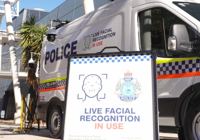
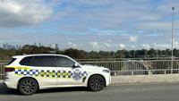
Recent coverage naming an Australian state or territory, a police force, or a national operator.



About this record
Australia's deployment data is compiled from the public record: police force and government publications, regulator decisions, state audit reports, and government open data. Each entry keeps its citation. The oversight around each system is the record's next layer, built from requests under Australia's federal, state, and territory information access laws; see the Australia records-law analysis. Until a body's records arrive, its oversight status reads not yet requested. Full notes on the methodology page.